Written by Annika
Edited on
19 June 2023
·
10:59
Navigating: navigation system vs smartphone
When do you choose a car navigation system and when do you choose a smartphone to show you the way? Both options navigate and both options have advantages and disadvantages. In this article you can read the most important functions of a navigation system compared to the 2 most popular navigation apps for your smartphone: Google Maps and Waze.
Compare a navigation system to a smartphone
| Navigation system | Smartphone | |
|---|---|---|
| Map coverage | Regular updates are necessary for up-to-date maps. | Updates aren't necessary and apps such as Google Maps are often already pre-installed. |
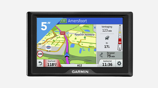
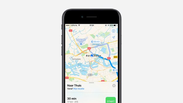
| Route | Clear and large display of your route. | Smaller and less elaborate display of your route. |
| Traffic updates | Very comprehensive and up-to-date. | Less detailed. |
| Bonuses | Anti-reflecting screen and hands-free calls without interrupting navigation. | Voice control that may be set for bike or pedestrian routes. |
Traffic information

Traffic updates on your navigation system
There are different ways to receive traffic information on your navigation system. One of the best and fastest options is via a car navigation system with built-in SIM card. Your device will receive information via 4G. The coverage of this technique is good and the information is refreshed quickly. For example, you'll know immediately when the traffic is stuck on the Coolsingel in Rotterdam. Receiving traffic information via SIM is free of charge in most cases, even abroad.

Traffic information on your smartphone
The navigation apps on your smartphone are more limited than your navigation system. Google Maps colors roads red when it is busy, but you don't get detailed information. Through Waze you get more information, only the traffic information on this app depends on users. The information is accurate, but information may be missing if no one has yet reported the situation. Waze does provide information about the maximum speed.
User-friendliness

Your navigation system's user-friendliness
You have to regularly update the maps on your car car navigation system for current information. With more luxurious devices, this can be done via WiFi more and more. Then you no longer need a cable and computer, but you update wirelessly. Depending on the maps on the device, a car navigation system also navigates abroad, without additional costs. With many car navigation systems, you can easily expand the maps.

Your smartphone's user-friendliness
If you own a smartphone, Google Maps is often already installed and you can get started right away. The apps determine your location with the GPS of your phone and keep the maps up-to-date. You use the mobile apps in the car, but on cycling and walking routes. The apps do use data. This means that it does not always work outside of Europe, or entails high costs. Without internet, the device does not have traffic information.
Extra features

Features of your navigation system
The screen of the average navigation system is the same size as that of an average smartphone (around 5 inches). Nevertheless, the display of your route on a navigation system is much clearer. For example, when you opt for a 3D view, you orient yourself even more easily in large cities. Many navigation systems allow you to make hands-free calls, operate the system with your voice, and connect your phone to receive notifications.

Features of your smartphone
With voice search via Google or Siri it is possible to navigate. For example, you say "navigate to Stadhuisplein in Rotterdam" and your phone searches for the route. You won't find other useful features of navigation systems on smartphones. Points of interest in your area are not indicated while driving, the sun reflects on the screen of your phone and the layout of the screen is less clear.
Conclusion
Navigation systems and smartphones both have their advantages and disadvantages. Your choice mainly depends on what you think is important and in which situation you want to navigate. Navigation systems are our preference in the car. These devices are made to make navigation in the car as easy as possible for you. Smartphones excel in convenience: you have the device already in your possession, maps are automatically updated and you also navigate with them on the bike or on foot.
Article by Annika
Navigation System Expert.
